The Best Hiking Trails in the Big Thicket

Unlike most national parks that have one main entrance and a clear path for exploration, the Big Thicket encompasses nine different ecosystems and 15 units, which are spread across multiple counties, offering acres upon acres of outdoors to explore. Each segment puts a cross-section of biodiversity on display that’s interspersed by waterways that are the lifeblood of the park and a highway for wildlife.

Described as the biological crossroads of America, there are four distinct vegetation types in the Big Thicket – eastern hardwood forest, the southwestern desert, the southeastern swamp, and the central prairies. Established in the ‘70s, you can see evidence of the logging industry, old roadways, and hunting grounds.

And while it’s incredible to have this massive habitat less than an hour away with 40+ miles of trails, it can feel intimidating to navigate or even know what to head, which is why we’re here to break it down for you. Whether you’re looking for a quick walk in the woods to take in the wildflowers or a longer, adrenaline-inducing trek to get really off the grid, there’s somewhere for everyone to explore in this natural petri dish right in our own backyard.

Collage of people exploring the Kirby Nature Trail

The Best Trail for a General Overview of the Area
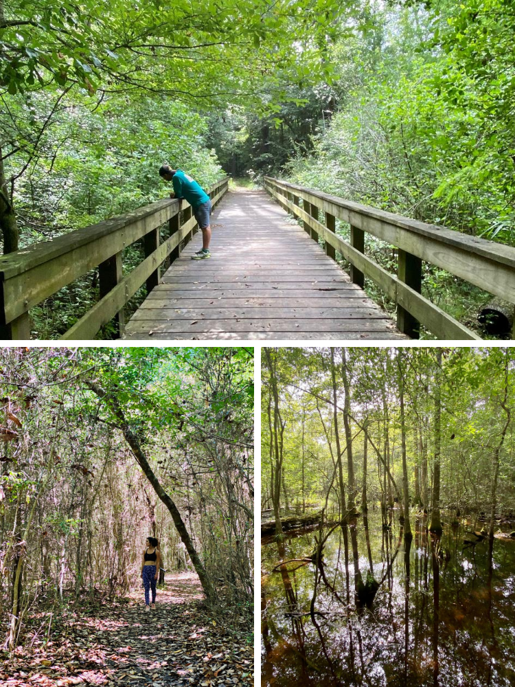
Kirby Nature Trail

As the main nature trail in the park, Kirby is a bit of a choose-your-own adventure. And despite being the most popular path, it’s likely you won’t see another soul and have the place all to yourself. There are a variety of routes ranging from 1.5-2.5 miles, which splits into an inner and outer loop, but you can also just do sections to make it shorter or combine it with other trails to extend your journey.

About .75 miles in is a bridge many people take photos at and where it connects up to the longer trails. At one point, it splits into a cypress slough and high-water bypass depending on what you want to see, but both junctures end up at the same place as long as you follow the numbered markers.

What to Expect: There’s a well-marked parking lot when you pull in on the left, a bathroom at the trailhead (which is temporarily closed), and an abandoned, illegal homestead at the beginning of the hike, which used to be the park office. There are clearly numbered signposts to follow so you know how far along you are, interpretive info as to what you’re looking at, and even designated selfie spots. The ground is dirt, gravel, and sand with benches throughout, making it fairly easy and accessible, but it is still deep woods, so dress and prepare accordingly. There’s ample tree coverage to keep it cooler and shelter you from the rain, but it still gets hot and very buggy.

Collage of plants and wildflowers on the Sundew Trail

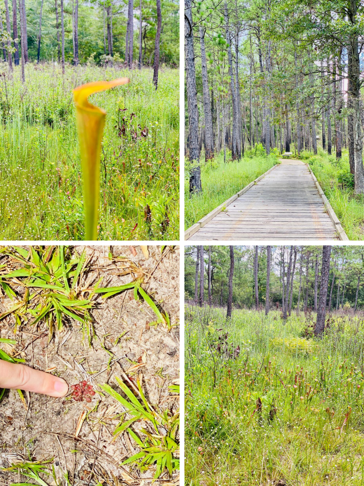
The Best Trail for Wildflowers or A Short, Quick Nature Walk

Sundew Trail

The quickest jaunt into nature, the Sundew Trail is named for one of the four carnivorous plants found in the Big Thicket (of the five that exist in America). The inner loop is the best for photos with .5 miles of raised boardwalks, while the outer loop is a bit longer at one mile. The springtime sees abundant wildflowers (peaking in March and April), but it’s green and lush year-round. Don’t expect an insane botanical landscape, what’s impressive here are all the little things working in tandem so try to be present and take in the details of your surroundings and the symbiotic nature of it all. The sundews themselves are tiny, dime-sized red blooms that catch prey with sticky tentacles. They’re hard to spot, so keep your eyes peeled and make it a scavenger hunt. There’s also a marker to identify the carnivorous pitcher plants, which have specialized leaves and open mouths to trap insects.

What to Expect: Don’t be thrown off when following Google Maps as it looks like you’re turning into a residential area, but it will take you to a covered picnic area at the trailhead. The well-maintained boardwalks make it accessible to all and the trees make it far less buggy and cooler. Note the toilet is temporarily closed.

The Best Trail for an Ecology Lesson

Pitcher Plant Trail

If you’re fascinated by the unique vegetation of the Big Thicket, the Pitcher Plant Trail is a .8-mile journey that puts the carnivorous plants on full display, making it easier to see the pitcher plants and sundews at the largest bog in the park. There’s a paved wetland savannah with hundreds of funnel-shaped plants waiting to catch their prey.

What to Expect: The first quarter mile to the bog is fully accessible via a paved boardwalk and then tapers off into hardwood/pine forest. The trail intersects with Turkey Creek in a few different spots, so be sure to follow the signs, or you’ll end up on a much longer route than intended.

The Best Trail for a Really Long Trek

Turkey Creek Trail

The longest route in the Big Thicket, the 15-mile Turkey Trail is much more remote and really off the grid, so know what you’re getting into and prepare accordingly. Six different trails link up to the loop, which you can do in segments to see several habitats from hardwood forests to cypress sloughs.

What to Expect: There are signs for Turkey Creek Trail on both the right and left of the road, which can be a bit confusing since there are so many entrance points. The main parking lot is to the right where the bathrooms are (but are temporarily closed for COVID). Bring a map and plot your route ahead of time because there is little to no cell service in the area.

For more trails and route information, visit the Big Thicket website.


Outdoor Areas to Explore